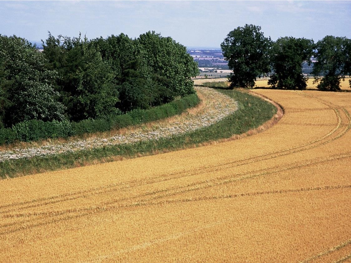
The UK Centre for Ecology & Hydrology is offering farmers a FREE and confidential Farm Health Check.
Image

Why are we offering a free Farm Health Check?
UKCEH has been awarded funding from UK Research & Innovation to support the transition of UK agriculture to what we call ‘Net Zero+’. Key to achieving this will be to provide farmers with free access to accurate and impartial, environmental data on their farm. We will use this knowledge to work with farmers to develop new sustainable and low-carbon farming systems.
Image

Sign up to receive a Farm Health Check report
The data used in the report is all either remotely-sensed or derived from your farm management data, if provided. That means all you need to do to get a report is complete the sign-up form*.
* By filling out this form, you are giving informed consent for us to use your data for the purpose of carrying out the Farm Health Check. Participation is voluntary, and you may withdraw at any time without giving a reason by contacting us at agzeroplus@ceh.ac.uk. If you choose to withdraw, we will stop using your data from that point forward. You can also request that previously collected data be deleted. Further information is available in the Farm Health Check Privacy Notice and Terms of Use.
What are we offering?
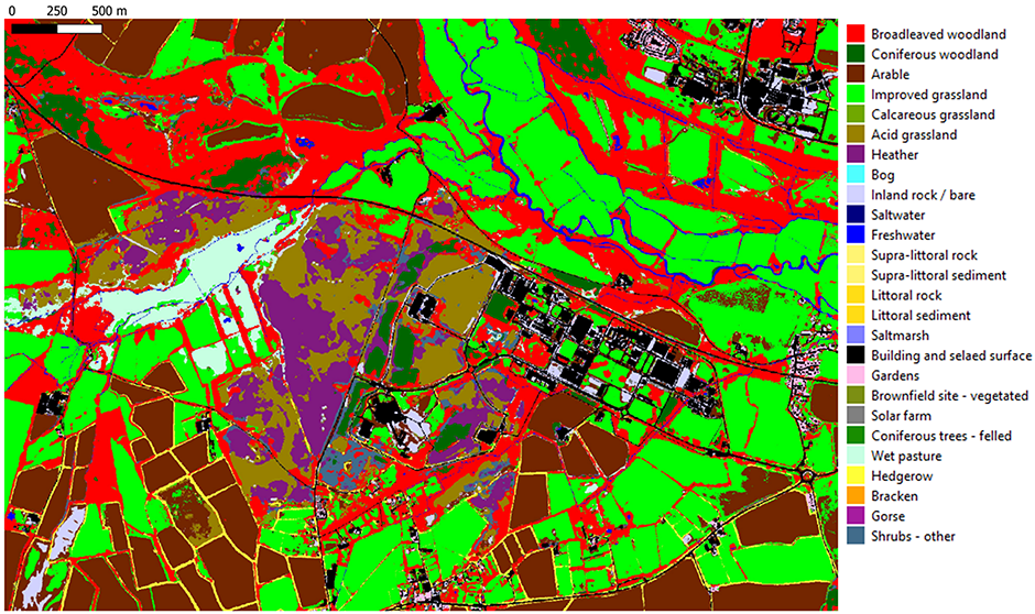
1. Natural capital assessments
- Land cover and habitat maps – based on the latest 10m resolution (or 3m where available) satellite data.
- Habitat connectivity metrics – describing the ease of movement of wildlife between different areas based on how joined up habitats are.
- Crop mappings and cover crops – reporting spatial and temporal patterns of crops within the landscape.
- Soil insights – mapping soil type, susceptibility to drought and waterlogging, carbon stocks (estimated using soil texture, land use, and cropping history derived from satellite data).
- Ecological status - how good your farm is likely to be for wildlife, including mammals, birds, reptiles & amphibians, and insects, compared to the surrounding landscape.
2. Impacts of farm operations
- Nitrogen use efficiency – calculated from fertiliser inputs and yield data.
- Pesticide risk – modelled using published toxicity of products, their timing of application, and their degradation rate. We measure the risks posed to soil biodiversity, pollinators and aquatics species.
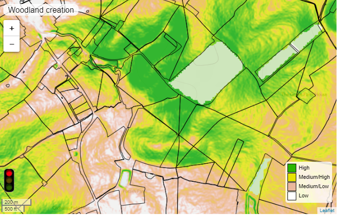
Environmental opportunity mapping
Once you know what you have on your farm, and how your farm operations translate into environmental effects, you can look at what you could do to mitigate the environmental impacts of your farming system.
We provide e-Planner, 5m-scale environmental opportunity mapping for every farm based on detailed data on soil type, topography, aspect, and landscape composition. The e-Planner maps suitable sites for woodland planting; pollinator and wild bird habitat creation; water resource protection and natural flood management.
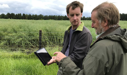
How to get involved
Natural capital assessments & Environmental opportunity mapping
For these parts of the Farm Health Check, what we need depends on the location of your farm.
For English farms: We simply need your SBI number which will be requested in the sign-up form (link above).
For Scottish farms: You can download your farm boundaries by following the Rural Payments Scotland guide (Section 2.3, Exporting Shapefiles). Please email your shapefile to agzeroplus@ceh.ac.uk after completing the sign-up form.
For Welsh farms: You can download your farm boundaries by following the Rural Payments Wales guide from page 43 onwards, found here: Rural Payments Wales guide. Please email your shapefile to agzeroplus@ceh.ac.uk after completing the sign-up form.
Impacts of farm operations
To assess the impacts of farm operations, you need to provide your farm management data. You can share this with us via Gatekeeper or Omnia. We will contact you about how to do this when you complete the sign-up form. If you choose not to provide these data, you can still receive the other sections of the Farm Health Check.
Once we have completed your farm health check, we will return all the outputs to you as a html report.
Keeping your data safe and confidential
UKCEH fully comply with all current data protection regulations, and we ensure all personal data is kept securely.
- UKCEH will not publish or share identifiable farm-level information with external organisations without an appropriate legal basis or your permission.
- Farm Health Check data may be used by UKCEH for agricultural and environmental research.
- Aggregated and anonymised information may be used for benchmarking and shared with research collaborators.
- Identifiable farm-level information will remain under UKCEH’s control and access will be limited to authorised individuals with a legitimate research or operational need.
- Further information is available in the Farm Health Check Privacy Notice and Terms of Use.
Sign up to receive a Farm Health Check report
For more information contact
Richard Pywell - rfp@ceh.ac.uk
Grace Skinner - GraSki@ceh.ac.uk
John Redhead - johdhe@ceh.ac.uk
Margaret Bolton - marbol@ceh.ac.uk